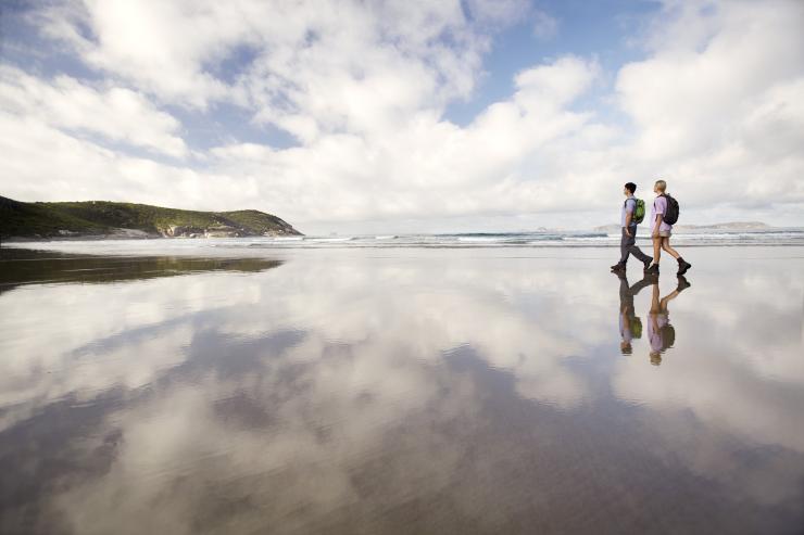
Pillar Point, Wilsons Promontory, Gippsland, Victoria © Visit Victoria
The best walks and hikes at Wilsons Promontory
Explore the natural sanctuary of Wilsons Promontory on its many well-marked walking trails.
By Ellie Schneider
Affectionately known as "the Prom", Wilsons Promontory encompasses 505sq km (195sq mi) of coastal wilderness on the southernmost tip of mainland Australia. The reserve is threaded with many walking trails, which wind their way through uncrowded beaches, eucalypt forests, cool rainforest gullies and rocky mountaintops. Visitors can camp, caravan or stay in cabins and lodges at Tidal River, a three-hour drive south-east of Melbourne.
Loo-errn Track to Tidal River and Squeaky Beach

Squeaky Beach, Wilsons Promontory National Park, Victoria © Garry Moore/Visit Victoria
- Duration: 1.5 hours
- Distance: 4km (2.5mi)
- Grade: Easy
Winding along the Tidal River banks towards the coastline, this two-part walk connects Loo-Errn track with Squeaky Beach walk. Loo-Errn is an easy 30-minute walk and, with wheelchair access, it’s perfect for people with limited mobility. Start at Tidal River's information centre and wander the boardwalks through swamp paperbark forest and over delicate wetlands to the river. Walk over the footbridge, where you can fish or watch for birds. Here, you can also take a short detour to Pillar Point, where the lookout offers awe-inspiring views over Norman Bay and the islands. Back on the Tidal River footbridge, follow the Squeaky Beach Track (for one hour) to stroll along white quartz sand that squeaks beneath your feet.
Mount Oberon Nature Walk

Mount Oberon, Wilsons Promontory, Victoria © Hannes Becker/ STA Travel/ Visit Victoria
- Duration: 2 hours
- Distance: 7km (4mi)
- Grade: Moderate to difficult
Watch the vegetation change on this steady two-hour return climb to Mount Oberon's summit. Start at the Telegraph Saddle car park and follow the short series of steps to the rocky outcrops on the mountaintop. At the summit you'll be rewarded with panoramic views over Tidal River, the coast and offshore islands. Be sure to pack warm clothing as the summit can be cool and windy even during summer (December to February).
Lilly Pilly Gully Nature Walk

Wombat, Wilsons Promontory, Victoria © Visit Victoria
- Duration: 1.5 hours
- Distance: 5km (3mi)
- Grade: Easy
Discover the Prom's diverse vegetation and colourful cast of wildlife on this 5km (3mi) loop. Start at the Lilly Pilly car park and wind through eucalypt forests, coastal heathland and temperate rainforest. Watch kangaroos, wallabies and emus graze in the clearings and wombats scuttle across the path. Stop halfway at the pretty picnic point, and share the views with crimson rosellas. Watch out for colourful spring flower displays (September to November) along the coastal heaths.
Read next
Top tips for viewing wildlife in Australia
Norman Lookout

Norman Beach, Wilsons Promontory, Victoria © Visit Victoria
- Duration: 1.5 hours
- Distance: 6km (4mi)
- Grade: Easy
Starting at the Tidal River information centre, climb over sand dunes sprouting tea trees to the southern end of Norman Beach, a great spot for swimming, beginner surfing, windsurfing and boating. From here, it's an easy climb around the side of Norman Point Lookout where you’ll be treated to views across to Little Oberon Bay and out to the Anser and Glennie Island groups in Bass Strait. Look out for the craggy form of Cleft Island, also known as Skull Rock.
Vereker Outlook Walk and Millers Landing Nature Walk

Vereker Outlook, Wilsons Promontory, Victoria © Hannes Becker/ STA Travel/ Visit Victoria
- Duration: 2 hours
- Distance: 6km (4mi)
- Grade: Moderate to difficult
This loop to Vereker Outlook and Millers Landing winds through banksia woodland, stringybark forest and colourful heathlands, and offers postcard views of Darby Saddle, Corner Inlet, Shellback Island and Cotters Beach. You'll share the trail with local wildlife such as emus, wallabies and kangaroos. On your return, follow the Millers Landing Link Track to meet the Millers Landing Nature Walk. Hug the shores of Corner Inlet, where you'll see the world’s southernmost stand of mangrove trees and a rich variety of waterbirds.
Darby River to Tongue Point

Sparkes Lookout, Wilsons Promontory, Victoria © Visit Victoria
- Duration: 5 hours
- Distance: 9km (6mi)
- Grade: Moderate to difficult
The Darby River to Tongue Point walk is a favourite among local hikers. Starting at Darby Saddle, tackle the steep ascent to soak in the magnificent views from Sparkes Lookout. From here, snake through the stringybark and Casuarina forest trail, boasting ocean views, wildlife and fascinating rock formations. Walk a little further to Lookout Rocks, where views take in the offshore islands and Tongue Point far below. After the lookout, the path descends steeply; join the Darby River track and continue to Tongue Point, the very tip of the windswept peninsula where waves batter the bright orange rocks below. The views are spectacular in the late afternoon light.


